“If you are considering GIS as a career, I strongly suggest that you look at UConn, which, unlike many schools, has a well-established, highly reputable Department of Geography. So as a student, you get access to the same superb level of instruction and expertise as other graduate students.” — Mary Buchanan, Graduate, Geographic Information Systems Online Graduate Certificate Program
 Mary expects that her training in Geographic Information Systems (GIS),
along with an MA from the University of Connecticut, will set her on the
path for success, no matter where her journey takes her.
180⁰ Switch
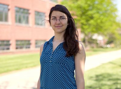
Mary Buchanan is now in graduate school with the Department of Geography at the University of Connecticut (UConn). She’s working her way toward earning an MA in Geography—quite a switch from her undergraduate studies in Ornithology. She caught the geography bug—and specifically, a love for Geographic Information Systems (GIS)—in 2015, shortly after being hired as a Conservation Associate at Highstead Foundation in Redding, CT. That following year, she earned the GIS Online Graduate Certificate from UConn, and now she says, she’s totally hooked!
When Mary Buchanan was an undergraduate at Connecticut College majoring in Biological Sciences, she originally wanted to concentrate in Ornithology. Had she gone straight to grad school after earning her BA, she thinks she would have stayed in the field of Biology, and most likely continued to pursue the study of birds.
Little did she know that taking two Geographic Information System (GIS) courses while an undergrad would steer her life in a new direction. About four months after graduating in May 2014, Mary landed an internship and later a job as a Conservation Associate with Highstead Foundation, a conservation organization based in Redding, CT. “I credit those GIS courses for my having secured my first internship with the Highstead Foundation,” she notes.
In fact, half of what she did as an intern required the use of Esri’s ArcGIS, the most widely used GIS software in the world. “Sure, I had some basic knowledge of GIS, but I hadn’t had much formal training in ArcGIS,” she notes and adds that her supervisors on the job weren’t GIS users themselves. “When I first started the job, I sometimes muddled my way through – getting where I needed to go in GIS, but not very efficiently. I found myself constantly doing workarounds.”
Learning the tricks of the trade.
To get the formal training she felt she was lacking, Mary enrolled in the GIS Online Graduate Certificate Program at UConn in January 2015, which she completed the following January. “I thought doing some kind of structured program with an actual curriculum would give me a much better grasp of the scope of GIS and how to take full advantage of the power of ArcGIS. And it really helped!”
As she quickly discovered, she was able to put the skills she learned in the certificate program to immediate use at her internship. “There were a number of different tricks that I didn’t know prior to taking the various courses. Those tricks of the trade have saved me an enormous amount of time on the job and given me a much broader understanding of the tools within the ArcGIS tool boxes. I also really appreciate the Mastering ArcGIS textbook we were assigned and continue to use it today.”
Jumping online when it was convenient.
So what about the online platform? Good? Bad? Indifferent? Before enrolling in the program, Mary had never done an online course. What she found surprised her. “When I’m sitting in a classroom, there are no distractions. But working on assignments at my kitchen table required me to develop a different learning style. I had to be more self-motivated and hold myself personally accountable for getting the work done.”
Mary also loved being able to jump on and off the HuskyCT platform (powered by Blackboard) when it was convenient for her, especially since her day-to-day schedule was erratic. “My work schedule at Highstead varied from week to week; I had to be available for my co-workers when they needed me. Plus I traveled around New England quite a bit. So it was very helpful being able to access the courses from my computer, no matter where I happened to be.”
Practice makes perfect.
But were the demands of the program too much with her full-time job? “Actually, I am so happy I decided to earn the certificate while I was at Highstead, despite my busy schedule,” she says. “If I had waited to enroll in the program, I wouldn’t have gotten as much practice. And I never would have found some of the little tricks in ArcGIS functions like the changeable parameters in the selections tool, which literally saved me hundreds of hours of time. I also loved that we could design our own final project, which allowed me to explore an area that was of specific interest to me,” and she adds: “The certificate program is well-rounded and something I found feasible to do along with other commitments.”
Now onto earning an MA in Geography from UConn.
Mary did finally decide to return to school to get her Master’s in Arts—but not in Biology. She chose the Geography Graduate program at UConn and expects to earn her MA in 2018. “After the experience at Highstead, I didn’t want to lock myself into studying only one field. I realized how much I love GIS, how applicable it is to so many fields, and how much I still have to learn. I knew I wanted to pursue it further.”
As a graduate student at UConn, Mary is now immersed in a landscape scenarios project for her graduate thesis. Among other functions, she plans to use GIS to create different mapping scenarios that will show potential ways sustainable agricultural land in Connecticut can be increased, for example expanding existing farms or looking at town-owned lands to lease to farmers. She expects one course she took—GEOG 5510 – Applications of GIS—to be especially useful. “The course gave me more practice in spatial analysis for real-world problems and experience in designing my own projects.”
Says Mary: “If you are considering GIS as a career, I strongly suggest that you look at UConn, which, unlike many grad schools, has a well-established, highly reputable Department of Geography. As a student in the GIS online program, you get access to the same superb level of instruction and expertise as other Department of Geography graduate students.”
“The GIS training I received was important and helpful in providing a foundational understanding and skill set, especially of ArcGIS. If you have an interest in GIS, I think you’ll find that earning this certificate is well worth the investment.” — Frank Griggs, Geographic Information Systems Online Graduate Certificate Student
 Having completed the Geographic Information Systems
Online Graduate Certificate Program in 2015, Frank Griggs
now uses the skills he learned to further his PhD dissertation.
A Wise Investment
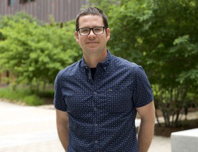
The subject of Frank Griggs’ PhD dissertation led him to discover the Geographic Information Systems (GIS) Online Graduate Certificate Program, offered through the University of Connecticut (UConn). Having completed the program in 2015, he now uses his new skills to conduct research in support of his dissertation. And looking ahead, he firmly believes that the investment in the GIS program will be well worth the effort when he starts looking for a job next spring.
You must really believe in the importance of taking the time to pursue a new skill, especially when you’re already waist-deep in a very intense PhD program in Political Science. But for Frank Griggs, taking the Geographic Information Systems Online Graduate Certification Program was essential. As he explains, “My dissertation project examines claims that climate change will influence social-political conflict and violence by focusing on disaster-induced human displacement as a mediating condition. My project’s subject matter is not uniformly distributed within and across countries. This makes the spatial analysis capabilities of GIS vital to evaluating whether or not such relationships exist.”
GIS kept popping up.
Frank notes that he first became interested in GIS four years ago. As he became increasingly involved in his climate change research, references to GIS techniques and methods kept popping up. “As I delved further into my subject matter, I began to see untested hypotheses that are suitable to spatial analysis. Since I was already here at UConn for my PhD, it was natural for me to add the certificate to my course workload,” notes Frank.
Frank chose a “blended” program, in which he took two courses on the Storrs, CT campus and two online courses, including one of his electives, GEOG 5520 – GIS Modeling of the Urban Environment. “The flexibility of the online courses enabled me to do coursework at times that were optimal for me, allowing me to take care of my other professional and personal responsibilities more easily,” he notes.
A solid foundation in ArcGIS.
So, was Frank able to gain the training he needed in GIS by getting the certificate? Absolutely, he says. “The GIS training I received was important and helpful in providing a foundational understanding and skill set, especially of ArcGIS. Since earning the certificate, I’ve been able to undertake research for my dissertation that uses GIS spatial analysis. In addition, I still use the assigned textbook, which provides practical, clear information and corresponding examples.”
Maybe academia, maybe private industry.
What’s next on the horizon? Frank anticipates that he will complete his PhD program in the spring of 2018, after which he plans to seek a faculty position in a college setting, potentially even as a GIS instructor. But, says Frank, “If I can’t find just the right job in academia, I know from other students who have earned the UConn GIS certificate, my GIS training could lead to a lucrative position in private industry.”
In conclusion, Frank says, “I appreciate the course instructors for being available and gracious about answering my questions.” Frank also felt very supported by Rich Mrozinski, UConn’s GIS Instructor/Lab Manager and GIS Certificate Program Coordinator, and Dr. Chaunrong Zhang, UConn Geography faculty member/GIS Instructor. As Frank says: “I sure got my money’s worth with all the visits I made to Rich and Dr. Zhang’s office hours. I am grateful to them for their time and guidance. If you have an interest in GIS, I think you’ll find that earning this certificate will be well worth the investment. “
“All of the courses I took were excellent; I got a solid working knowledge of ArcGIS. I was also given a choice of 10 different electives, which allowed me to tailor the program to my expertise in Natural Resources.” — Jacob Conshick, Geographic Information Systems Online Graduate Certificate Program student
 Jacob Conshick’s skills in GIS have come in handy
in more ways than one.
Trees, Snow, Cottontails, and Oil Spills
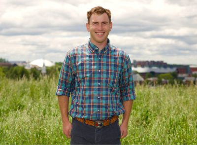
What do these four things have in common? Geographic Information Systems (GIS)! In fact, GIS is used in an incredibly wide range of applications. Just ask Jacob Conshick. After having completed the GIS Online Graduate Certificate Program, along with his Master’s in Natural Resources from the University of Connecticut (UConn), he works as UConn’s in-house GIS expert. He also does volunteer work for the Connecticut Department of Energy and Environmental Protection and is enlisted in the Coast Guard Reserve. How has his GIS training served him in his various roles? You might just be amazed!
It’s no surprise to anyone living in the New England area that when Nor’easters scream up the East Coast, we can get dumped on, big time. UConn is no exception. This past winter, we received more than four feet of snow. So how do you make sure students are able to get to class as quickly as possible? How do you keep everything running smoothly?
Call in Jacob Conshick!
Call in Jacob Conshick! As GIS Analyst at UConn, Jacob draws upon the skills he earned from participating in UConn’s GIS Online Graduate Certificate Program to determine the best truck and tractor routes to remove snow as quickly as possible. This is no easy task, considering the terrain and network of roads on campus. “We use the data in our ArcGIS system anytime there’s an accumulation of snow to be sure we can get our roads plowed and open as easily and quickly as possible,” explains Jacob.
Mapping one of the nation’s official campus arboretums.
So what does he do when snow storms aren’t keeping him busy? If you’ve ever been on the UConn Storrs campus, you might have noticed small metal tags pinned to trees. Each of those tags has a number that corresponds to a record of the tree in UConn’s GIS system. One of Jacob’s primary jobs is to map trees located on campus. So why is this important? UConn is one of the nation’s official campus arboretums, and as such, we are required to keep track of our trees for funding purposes. In addition, having a record of the trees on campus is useful for teaching purposes—and of course, for maintenance and construction crews. Knowing the location and significance of our trees allows Facilities and Architectural Engineering Services to plan accordingly when it comes to everything from road realignments to the construction of new buildings.
“Using our GIS system, we track a lot of details about our trees—their species, size, location, any especially notable characteristics, among other data,” says Jacob, who adds: “We even track if a tree has been planted in memory of someone. Today, we have about 4,000 trees that are part of our GIS data set.”
At his own pace, on his own schedule.
Despite having a job in GIS now, Jacob didn’t start out at UConn thinking he’d focus on this specialized area. But while earning his Master’s in Natural Resources at UConn, he quickly realized the importance of acquiring GIS skills for any job he might apply for in the future. He started the program in 2014, ultimately taking the two required core courses online and his two electives on-campus. The credits he earned were also applied to his Master’s degree.
“I’ve always been a big advocate for taking courses in a traditional classroom setting,” says Jacob. “So I was really surprised at how much I liked the online portion of the program, especially because I could go at my own pace and schedule, as long as I met weekly deadlines. The faculty who designed the courses did an outstanding job at structuring the weekly modules. And the instructors always responded quickly whenever I had a question.”
Course content: A+
Jacob also gives the course content high marks. “All of the courses I took were excellent; I got a solid working knowledge of ArcGIS. I was also given a choice of 10 different electives, which allowed me to tailor the program to my expertise in Natural Resources and to apply the principles of GIS in a variety of different ways. The textbook for GEOG 5500 – Fundamentals of GIS was a great resource as well. In fact, I still use it today.”
In addition to his position at UConn, Jacob also does volunteer projects for the Connecticut Department of Energy and Environmental Protection. For example, he’s involved in a project using ArcGIS to understand and determine the location and distribution of Cottontail rabbits in Connecticut.
Using his GIS skills as a Coast Guard Reservist.
Jacob also recently joined the Coast Guard Reserve in order to, as he says: “Be part of something bigger than myself.” As he explains, the unit he’s assigned to is responsible for monitoring fishing vessels and responding to pollution problems, including mapping oil spills, throughout Southeast New England. “My unit supervisor is very aware of my GIS skills and has talked to me about ways the Coast Guard can utilize these skills in the future.”
Jacob has already recruited two of his fellow Master’s students to enroll in the GIS Online Graduate Certificate Program. “I think anyone in Natural Resources or Engineering would benefit from the program. GIS is a huge part of just about any job relating to the environment. I strongly urge you to consider taking this if you’re not strong in the fundamentals of GIS. Employers are looking for candidates who show the initiative to dive into their specialty areas by getting grounded in GIS.”